Geographic Information System (GIS)
GIS is becoming increasingly important as a cost-effective means of data analysis and presentation in a wide range of specialties. GIS is also a necessary tool in a decision-making process for strategic planning and location selection across disciplines.
About the Certificate Program
The objective of the stand-alone program is to certify a student’s satisfactory completion of a series of courses designed for professional GIS training and education at Stockton University.
In addition to professionals in the fields of natural sciences such as environment, marine, ecology, biology, geology, and renewable energy, as a powerful tool, GIS is also used by politicians, public health officials, regional planners, first responders, business marketing professionals, and many others. The GIS Certificate is the right choice for professionals interested in advanced skills in computer mapping, spatial modeling, and spatial data-mining technologies.
Program Coordinator

Min Kook Kim
Assistant Professor of Environmental Studies
A&S-220 | 609-626-3624
Curriculum
The University GIS Certificate Program is designed to provide students with a robust foundation in geospatial technology and science, while offering flexibility to tailor advanced coursework to their disciplinary interests. This program is suitable for students across diverse fields, including marine science, public health, anthropology, computer science, business, hospitality/tourism, and other disciplines with spatial analysis needs. It is also appropriate for graduate students seeking to enhance their geospatial skillsets.
Admission Prerequisites (Select One)
To be eligible for enrollment in the GIS Certificate Program, students must have completed one of the following prerequisite courses or an approved equivalent:
- Introductory Statistics (preferably at the 2000-level or higher, e.g., ENVL 2400 - Statistical Analysis of Ecological Systems)
- Field-Specific Research Methods course (e.g., MARS 2200 - Marine Biology Methods and Analysis)
- MATH 2215 - Calculus I
- A comparable quantitative or methodological course, subject to program coordinator approval*
* The program is committed to promoting interdisciplinary accessibility and encourages applications from individuals in non-STEM fields, such as Anthropology, Public Health, and Hospitality/Tourism, as well as from prospective graduate students. We welcome any specific questions you may have regarding the admission prerequisites for the certificate.
Core Curriculum Requirements
Foundational Course (Required for All Students)
- ENVL 3302 – Geographic Information Systems (4 credits)*
This course provides a comprehensive introduction to GIS, including spatial data models, geoprocessing techniques, and map design/cartography.
* Students who have previously completed a GIS course may be eligible to waive ENVL 3302. In such cases, students will substitute an additional upper-level geospatial course to fulfill credit requirements.
Advanced Coursework
Tier 1 – Advanced GIS Tools and Methods (Select One*):
- ENVL 3303 – Advanced GIS (4 credits)
Advanced topics such as web mapping/applications, mobile GIS, data engineering, and scripting applications in GIS.
- ENVL 3304 – Remote Sensing (4 credits)
Remote sensing fundamentals, image processing, and satellite data analysis.
* If one is taken here (Tier 1), the other may be taken as an elective in Tier 2.
Tier 2 – Specialized Geospatial Applications (Select 4 Credits):
Choose courses totaling at least four credits from the list below:
Course
Title
Credits
ENVL 4622
GPS for GIS*
2
ENVL 3307
Geodatabase and Web Mapping**
2
ENVL 3308
LiDAR Applications*
2
ENVL 4302
Applied Geospatial Analysis*
2
ENVL 4201
Spatial Statistics***
2
CIST 3222
Database Systems
4
CIST 2110
Programming in Python
4
* Specialized technical modules for advanced spatial data acquisition and analysis
** Under evaluation for future offerings
*** Renaming and potential credit increase under consideration (e.g., Spatial Statistics
and Modeling, 4 credits)
Capstone Requirement
- ENVL 4900/4800 – GIS Internship* or Senior Project** (4 credits)
Students must complete an applied geospatial internship or independent research project under faculty supervision, integrating technical, analytical, and communication skills developed throughout the certificate.
*Students must have completed ENVL 3302 or an equivalent course as a prerequisite
for this capstone requirement.
**Students are required to receive research proposal approval before registering for
this capstone requirement.
Additional Notes
- A minimum of 16 credits is required beyond the prerequisite coursework.
- A grade of C or higher is required in all program courses.
- Program progression is customized based on the student’s background, disciplinary focus, and career goals.
- Students are encouraged to meet regularly with their preceptor and/or the Center for Academic Advising to ensure all requirements are fulfilled.
- Click here for the GIS Certificate Advising Sheet
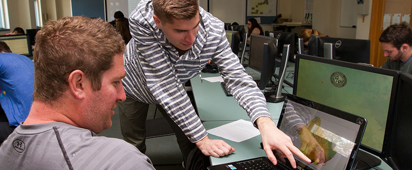
Laboratory & Facilities
The ENVL program stresses the acquisition of skills including geographic information systems (GIS), which generate computer maps and link databases, and global positioning systems (GPS), which are used to accurately locate geographic positions. We also have lab spaces in the A&S building with hydrologic, soils, wildlife, and tree measuring technologies, as well as the latest Global Positioning System equipment, including a Leica RTK unit.
The computing capabilities of the GIS program center on two computer labs, AS202 and AS209. AS202 is a regular 20-seat computer lab with a faculty podium equipped with a projector and document camera. AS209 has some of the most powerful machines on campus for student use.
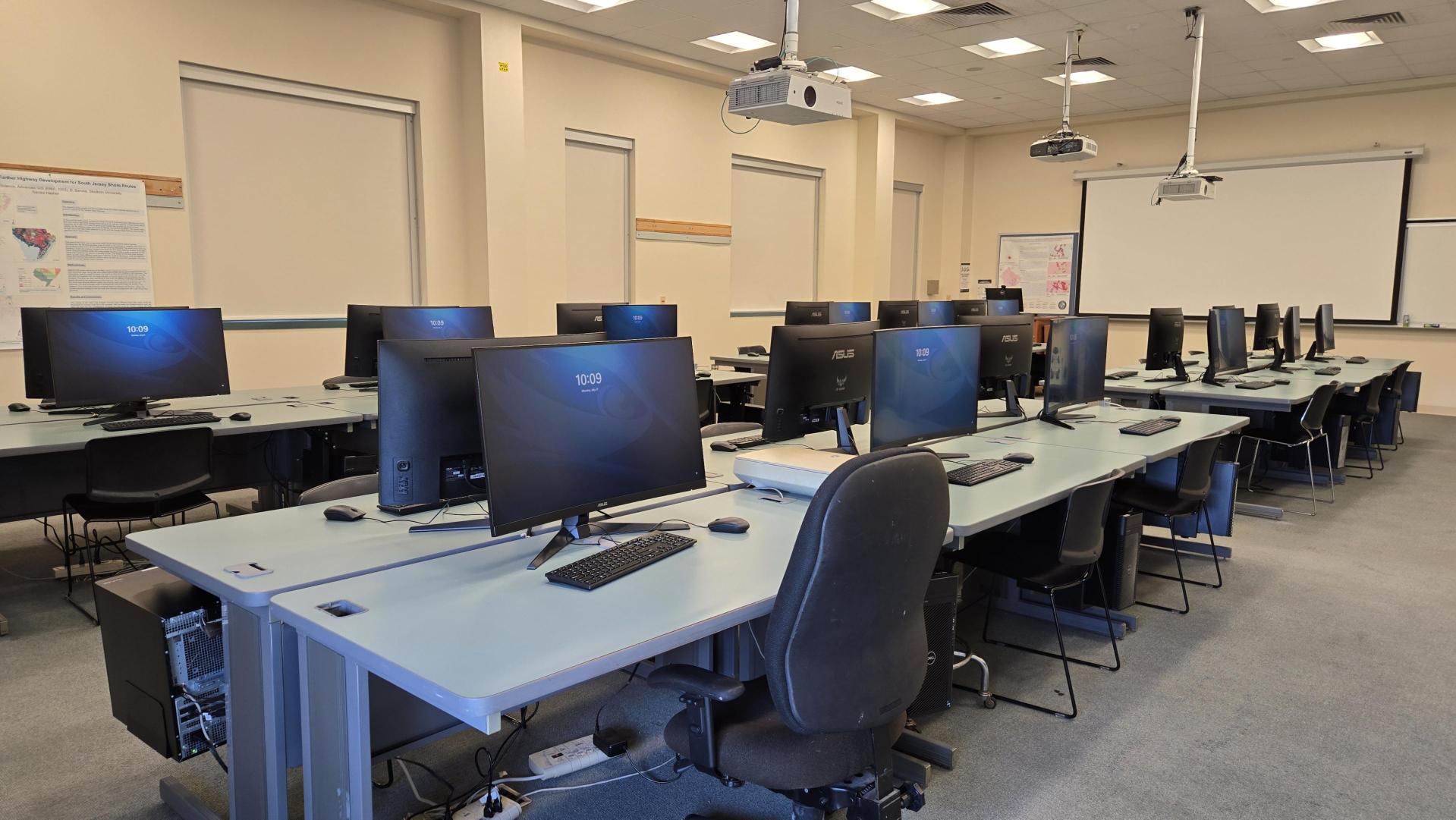
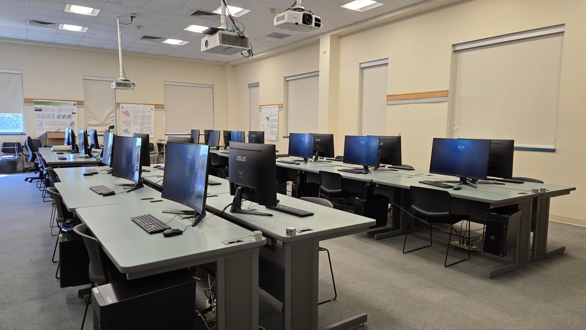
There are 26 student computers and a faculty podium in the room. All machines are equipped with an Intel i9 processor (24 cores @ 5.8 GHz), Nvidia RTX 2000 Ada (16 GB GDDR6), 32 GB DDR5 RAM, 1TB SSD, and a curved 32-inch monitor at each student station.
The faculty station is connected to three projectors in the classroom. The main projector
is in the front of the room, and there are two additional projectors on the sides. Each of the additional projectors is also connected to a single collaborative student
workstation that can be used for group viewing or working on a collaborative project.
Both labs have the ability to print b/w and color laser prints as well as access to
a 44" plotter for doing large and oversized prints.
Computer-based Software Used to Store, Visualize, Analyze, and Interpret Geographic Data
- ArcGIS Pro/ArcGIS Online
- ERDAS IMAGINE/ER Mapper
- TerrSet liberaGIS
- Quick Terrain Modeler
- Other geospatial software/plug-ins
In addition to professionals in the fields of natural sciences, such as environment, marine, ecology, biology, geology, and renewable energy, as a powerful tool, GIS is also used by politicians, public health officials, regional planners, first responders, business marketing professionals, and many others. The GIS Certificate is the right choice for professionals interested in advanced skills in computer mapping, spatial modeling, and spatial data-mining technologies.
Potential Careers
GIS skills are transferable to many industry sectors, giving a broad base of job options and career choices.
Common uses of GIS include:
- inventory and management of resources
- crime mapping
- establishing and monitoring routes
- managing networks
- monitoring and managing vehicles
- managing properties
- locating and targeting customers
- locating properties that match specific criteria and managing agricultural crop data
- addressing public health concerns
- mapping wildfire risk and preparedness
- modeling hazmat risk
- first response
- mapping/monitoring/mitigating invasive species
The ENVL program and GIS certificate at Stockton University provided me with the technical skills, real-world experience, and professional confidence needed to succeed in a career focused on geospatial analysis and environmental problem-solving. Through hands-on coursework, I developed a deep understanding of the fundamentals of geographic data, including the structure, application, and limitations of vector and raster datasets. This strong foundation allowed me to approach complex spatial challenges with clarity and precision in both academic and professional settings.
Coastal Geospatial Analyst
Coastal Research Center
Occupational Outlook
"The U.S. government predicts GIS jobs will be in high demand over the next decade, with annual salaries of $70,000. The Bureau of Labor Statistics predicts growth of 35% a year, with a shortage of trained people to fill the jobs. Currently, the geoservices industry is valued at $270 billion and employs over 500,000 people. GIS is everywhere and can be a great career option for people who enjoy working with “big data” to produce interesting and insightful results. With the predicted growth, someone who enters this field can be reasonably assured of a good career path.”
EdFlo.com
Career Preparation
In addition, we have a student Career Center that is available to guide you through your career development journey - from CV writing, interview prep, or general guidance.

Interns of the Atlantic County Office of GIS use GIS and remote sensing software to provide maps, spatial data, and imagery for state, county, and municipal projects within Atlantic County. Projects include tidal monitoring, disaster prevention, flood hazard mitigation, strategic growth management plans, municipal mapping for zoning use, service area mapping, municipal roadway assessment for planning, providing census information maps, transportation analysis, and environmental impact analysis.
GIS Interns will also provide a range of services for the office, including scanning documents, printing maps, receiving GIS-related phone calls, updating Atlantic County website resources, updating County geodatabases, and providing resources to office walk-ins.
“As an Intern for the Atlantic County Office of GIS, my objective is to take my in-classroom training provided by the Stockton University professors and apply it to the professional real-world scenarios presented to Atlantic County’s Department of Planning and Development. I most enjoy being able to broaden my “toolbox” of techniques at Atlantic County and attending Atlantic County Office of Emergency Management meetings, where I am able to merge my GIS experience with my interest in emergency management and response. I am extremely grateful for my time at Atlantic County and the Specialists I have the privilege of working under. Being an Atlantic County Office of GIS intern has given me a year’s worth of new knowledge and techniques to tackle the ever-changing world of geographic information science.”
Emily Peraria
Atlantic County Department of Planning and Development Intern

