The Caldwell and Woodruff Saw Mill
By Sarah Galzerano
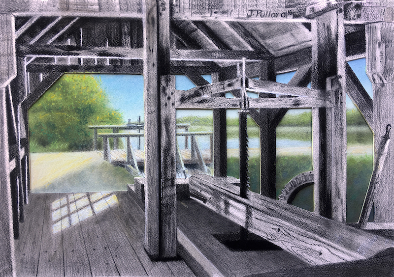 James Pullaro’s artistic interpretation of the Caldwell and Woodruff sawmill, Galloway Township, New Jersey, c. 1815, with the future Lake Fred in background.
In January of 1815, James B. Caldwell and Elias D. Woodruff constructed a sawmill near the southeastern corner of what would become known, first, as Saw Mill Pond and, eventually, as Stockton University’s Lake Fred. With Morse’s Mill Stream and Cedick Run flowing through this land, it was an opportune place to construct a dam and gain a source of valuable waterpower.
During the eighteenth and nineteenth centuries, due to South Jersey’s flat coastal plain and slow-moving streams, damming was necessary to create waterpower. Many dams have been built and blown over the years along this waterway. Currently, there are three dams located across Morse’s Mill Stream: the Lake Fred Spillway, one on Moss Mill Lake, and one in Port Republic, where the waters of Mill Pond meet Nacote Creek. Around 1774, Evi Smith, Hugh McCollum, and Richard Westcot constructed the dam in Port Republic and its accompanying saw and gristmill operations.
The Caldwell and Woodruff mill site on campus should not be confused for one of the Morse family mills, which were located about a half-mile downstream and constructed quite some time earlier. Robert Morse (also spelled Morss or Moss—thus Moss Mill Road) and his business partner, William Burnett, started building their sawmill as early as 1757. It sat on a 50-acre tract of land off of the Moss Mill Branch of Nacote Creek in what is today Swan Lake. Several years after selling this mill, in 1775, Morse constructed a gristmill on the opposite side of the dam. The operation stayed in the family until John Marshall acquired it in 1824; by 1862, Marshall had put the land (and the mills) up for sale.
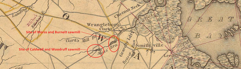
This detail from Thomas Gordon’s A Map of the State of New Jersey with Part of Adjoining States, Second Edition, Improved to 1833, denotes the location of both sawmills described above, located near present-day Port Republic and the settlement of Smithville, Galloway Township, Atlantic County, New Jersey.
Caldwell and Woodruff started running their mill, a sawmill, in the spring of 1815 and continued for just a few years. The six parcels of land they had acquired cost around $5,000, and only part of their purchase was the 111-acre tract of land on which they built the mill; the other land was largely used for cutting timber. By 1819, they had sold four of the six parcels of land, including the land on which the mill sat, to Nehemiah Blackman. When in 1820 Blackman had to report to the federal decennial census, he listed one gristmill and two sawmills on his land; the gristmill and the other sawmill were those built by Smith, McCollum and Westcot.
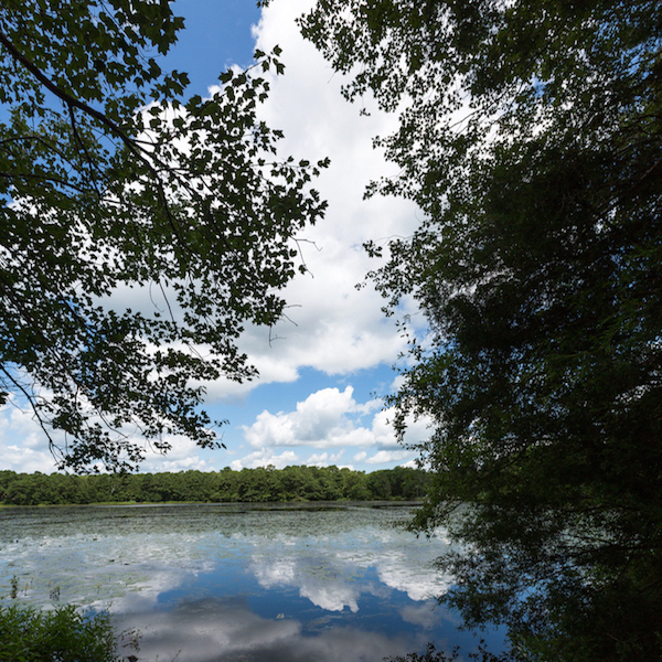 A present-day view of Lake Fred looking from the mill site.
It is unknown what became of the mill, other than it probably stood intact for several more decades. It was marked on the Gloucester Town and Farm Association plot map of 1860, but it did not appear on the F. W. Beers map of Atlantic County of 1872. What we do know is that in the twentieth century, the land and the lake entered into cranberry production after being acquired by Andrew Jackson Rider and George E. Gossler. John Lingelbach, one of the caretakers of the bogs in the 1920s, recalled the supposed collapse of the Caldwell and Woodruff sawmill.
Two centuries after its construction, local historians recognize that it was Caldwell and Woodruff’s dam that succeeded in creating the bodies of water that make up our beloved Lake Fred (including Upper Lake, Cedick Run Bog, and Lower Lake). Their sawmill was reciprocating, meaning that the blade was vertical rather than circular, and sawed the wood in an up/down fashion. It probably did not look like a closed barn, as most people picture mills, but rather an open structure. The waterwheel was a breast shot wheel, meaning that the height of the water flow from the headrace (carried on the flume) hit the wheel at mid length, not at the top or the bottom. While this type of wheel wasn’t the most common, it is arguably the most functional. The tailrace from the waterwheel of the mill is still visible if you look off to the right of the Light Path (heading north from Lakeside Lane), and it is one of three branches that in the past would have flowed into Nacote Creek, after rejoining Morse’s Mill Stream, of course.
Further Reading…
Paul W. Schopp. “Reimaging a Remnant of the Past at Stockton.” SoJourn 1, no. 2 (Winter 2016/17): 100–103.
Stockton’s Natural History Blog
https://blogs.stockton.edu/ssnh/
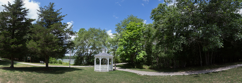
View of Lake Fred, the lit path, and mill site (in woods to the right of the kiosk).

