
Fall 2023 Issue
Located only a few miles north of Stockton’s main campus, the Little Egg Inlet is one of the state’s largest and last remaining natural inlets. What makes this inlet unique is the absence of any man-made stabilization structures, and up until 2018, the sand migrated naturally in response to storms without any dredging. It is a perfect testing ground for Associate Professor Anna Pfeiffer-Herber’s research to determine how erosion affects the functionality of the inlet.
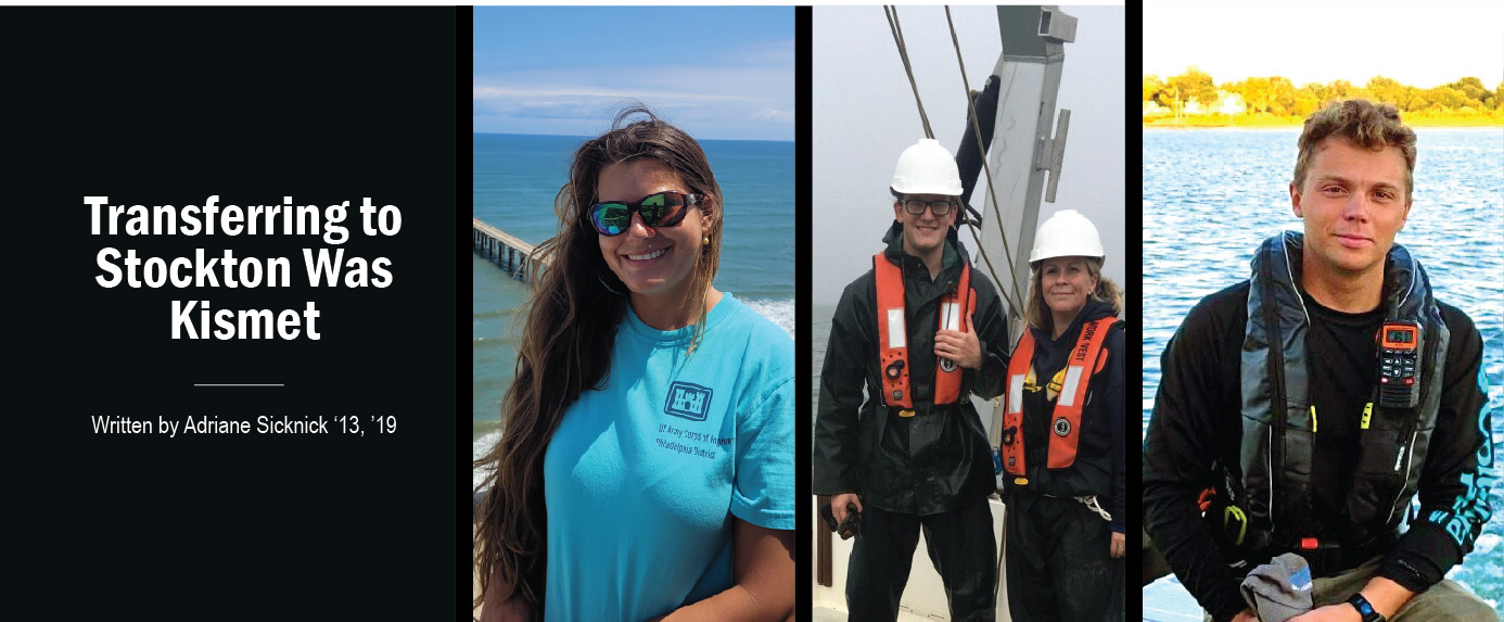
Over the past five years, Pfeiffer-Herbert had the pleasure of working with three top-notch marine science students who had assisted with her National Science Foundation (NSF) funded research – an extension on work she had done with the U.S. Geological Survey (USGS) conducted in 2018 – to investigating tidal currents in the Little Egg and Barnegat Inlets. Interestingly, the trio were all transfer students who ultimately found excitement in the underwater surveying research, which led to careers in the field. Alumni Nicole Ertle ’19, Peyton Benson ’21, and Taylor Davis ’23 each had an important role in Pfeiffer-Herbert’s research, starting with the USGS research in 2018 and the expansion into her NSF-funded research collaboration with Rutgers and Oregon State University.
The Beginning
Nicole Ertle, a current Coastal Zone Management graduate student, was the first to start working on the Little Egg Inlet tide cycle project in 2018. As a non-traditional transfer student, Ertle was eager to take on any hands-on experience that was given to her. During her first year at Stockton, she dove into a seagrass research independent study with Dr. Elizabeth Lacey, associate professor of Marine Science, in Barnegat Bay. It was during this research she realized her interest in the equipment used to measure water quality and made the transition to oceanography. As a preceptee of Pfeiffer-Herbert, she was asked to participate in the USGS research in the Little Egg Inlet. The project was her first experience with surveys and current profiling, measuring water velocity in the inlet and estuary system. “You’re out there for a full tide cycle ( a little over 12 hours) because, as part of the tidal analysis, we are interested in the subtidal flow through the inlet, so we need to subtract the tidal component from the data,” she explained. “[As a student] You’re getting your hands-on experience right off the bat.”
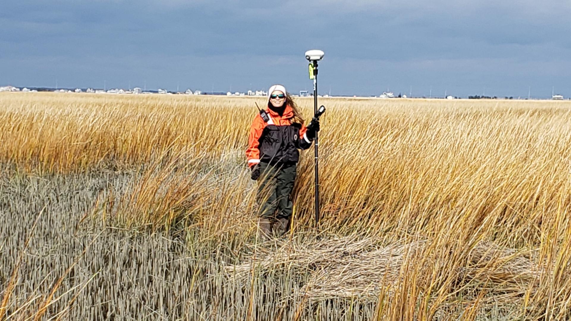
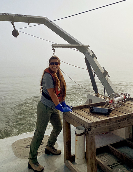
The team set out to capture a neap tide [Seven days after a spring tide, the sun and moon are at right angles to each other. When this happens, the bulge of the ocean caused by the sun partially cancels out the bulge of the ocean caused by the moon. This produces moderate tides, known as neap tides, meaning that high tides are a little lower and low tides are a little higher than average. Neap tides occur during the first and third quarter moon, when the moon appears half full. – NOAA National Ocean Service]. Ertle’s first run was 14 hours in total, running her favorite line, the outer inlet transect [a line from Holgate to Little Beach in the Little Egg Inlet], where the flushing starts and enters the estuary, and two additional lines on either side of the branch on the Great Bay side near the Rutgers Field Station, and one north entering Little Egg every hour to ensure they got the full tidal cycle – the high and the low. During these expeditions, Ertle would assist with the deployment of the Acoustic Doppler Current Profiler (ADCP), recording the data through the computer, pinging the instrument, and taking notes for quality control on the backend where the data analysis is key.
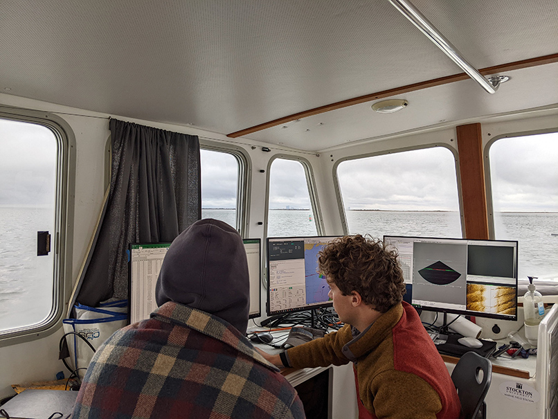
Once the data collection in the field was concluded, it came time for the nitty gritty analysis using MATLAB [MATLAB is a programming and numeric computing platform used by millions of engineers and scientists to analyze data, develop algorithms, and create models].
“To work with the data, it's trial and error. I would write down what I'm trying to do in my notebook and then figure out how to code it. I would see where I was getting errors or what's not making sense,” she went on to explain, “With coding, you don't want to keep spinning your wheels so much where you're not making forward progress…double checking your work and knowing when to check in [with Pfeiffer-Herbert] to work through it together is key.” Ertle’s work in MATLAB proved invaluable as it became the Standard Operating Procedures (SOP) for the project’s analysis which subsequent students would use and build on as the project progressed.
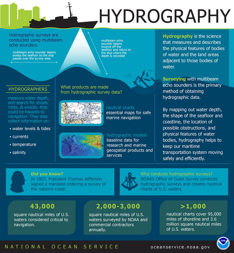
What is Hydrography?
Next up…
Next on deck (pun intended) was Peyton Benson. As a child visiting aquariums and spending time on the beach, he was curious about the living organisms he observed on his outings, like jellyfish and other marine animals. As he grew older, he didn’t feel a career in the field was feasible. He focused his attention on different majors at another four-year institution, but nothing stuck. He transferred to Stockton, and as he would put it, “something clicked.” Benson recalled, “When I started at Stockton…I didn't know hydrography existed within oceanography. But the more that I invested time and effort into classes, the more I discovered.”
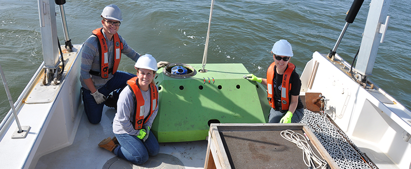
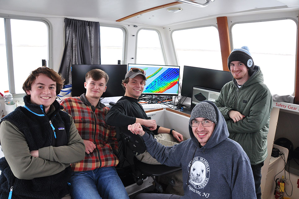
As with Ertle, Benson came to Stockton wanting to make the most out of his education and get as much hands-on experience as he could. He joined Pfeiffer-Herbert’s team after inquiring about work outside the classroom. His participation coincided with the re-establishment of the Stockton Marine Technology Society (MTS) [The SMTS promotes awareness, understanding, advancement, and application of marine technology. It also provides members with hands-on instruments, software, and field experiences, as well as networking opportunities with students and industry – OspreyHub]. Benson and the MTS student team also benefitted from the hands-on experience of deploying and retrieving the Acoustic Doppler Current Profiler (ADCP) on neap runs [Scientists use the ADCP to measure how fast water is moving across an entire water column. It is anchored to the seafloor and can measure current speed not just at the bottom, but also at equal intervals all the way up to the surface – whoi.edu]. Using the foundational analysis work started by Ertle, he picked up the data work and built on the analysis in MATLAB.
As Stockton migrated to a new survey software QPS [QPS focuses on system integration of survey sensors and the development of software applications used for hydrographic surveys, sea-floor mapping, portable pilot units and Electronic Navigation Charts (ENC) production.] Benson, the vice president of MTS, arranged with the field station for the students to shadow the faculty and marine field station staff training on the new survey software presented by Echo81. This experience led to a summer internship with the company.
Rounding out
Rounding out the trio was Taylor Davis. Davis came to Stockton also as a transfer student with an associate degree in Environmental Science. He came in with the mindset that he wanted to leave with a practical skillset. After talking with the Marine Field Station Director Steve Evert before enrolling, he learned about hydrography [ which measures and describes the physical features of the navigable portion of the Earth's surface and adjoining coastal areas. Hydrographic surveyors study these bodies of water to see what the "floor" looks like – NOAA] after expressing his interest in land surveying. Using self-identified filters, he would eliminate what he did not connect with to narrow down his choices. “I felt that I was applying a filter that was true to myself and not based off of other people's influences…it gives me confidence this is a path that I really do want to go down,” he explained.
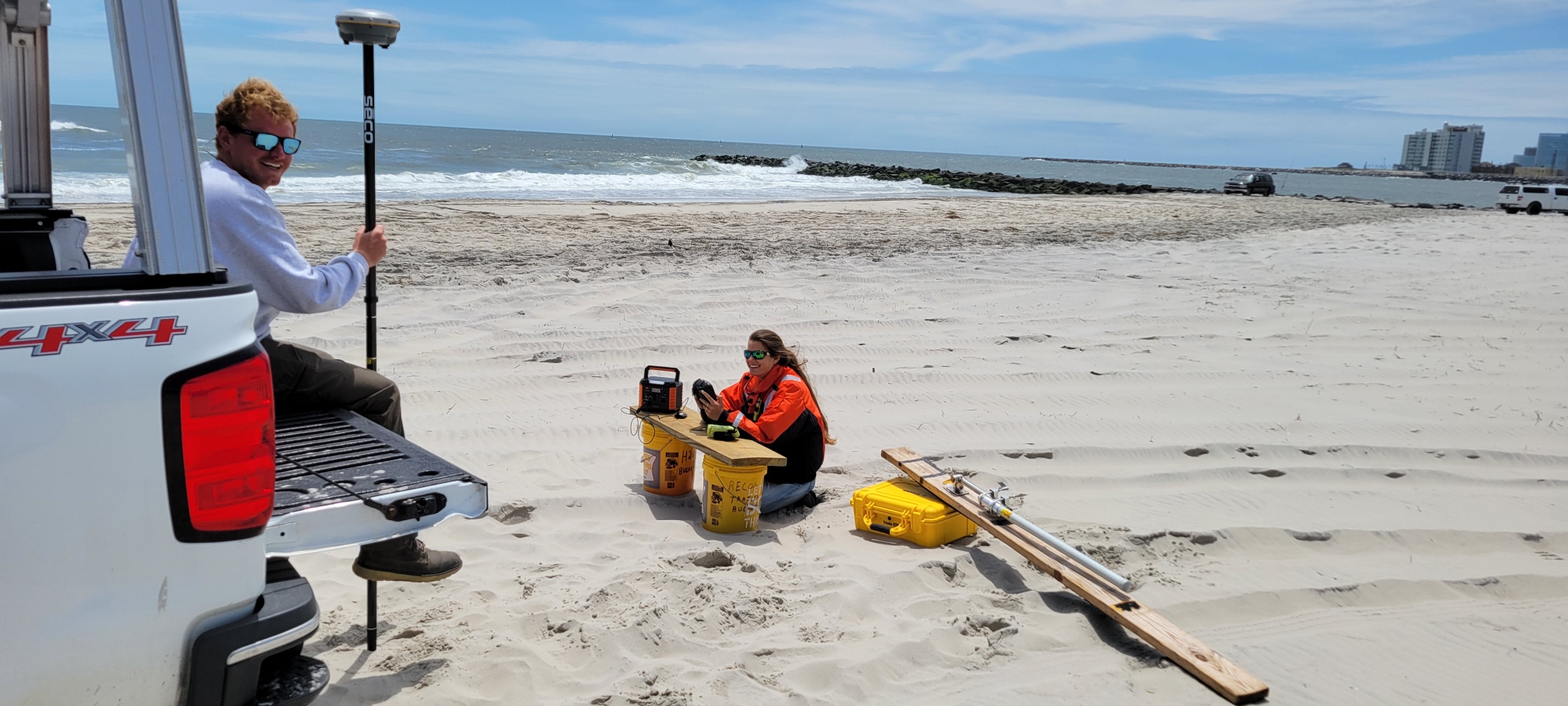
Davis took his experience one step further. Using Pfeiffer-Herbert’s data as inspiration, he built an independent study using the previous work in Little Egg Inlet and the hydrography and sonar experience from his internship at St. Hudson Marine Engineers to support her conclusions. Using the R2 Sonic multi-beam echosounder, they collected high-resolution bathymetric data (spatial survey) to look at the north and south channels of the inlet to identify if there was a slight favorance going inward on the North Channel and less favorance going outward on the southern channel. His conclusions were in line with Pfeiffer-Herbert. Davis explained the importance of his proposal and how changes happen over time, “Understanding the different circulation of water, how long is water staying in the Barnegat Bay, and how it is changing over time, adds a greater picture of estuary research, in particular in the hydrological regime.” He explained the importance of resurveying over time to see how things change over time, especially after highly impactful coastal storm events such as Super Storm Sandy.
More about the Trio
Nicole Ertle '19
Ertle originally transferred to Stockton as a Marine Biology major before switching to Oceanography after her experience with the equipment used in her seagrass research with Dr. Elizabeth Lacey. Ertle was able to gain experience in surveying the Little Egg Inlet through the USGS research. She credits the hands-on experience with her ability to secure a Hydrographer position with the Army Corps of Engineers after graduation.
“I love the hands-on mentorship that you get [at Stockton] right from the get-go unlike bigger schools,” said Ertle.
Ertle works out of the Atlantic City duty station, which is responsible for sounding the federal navigable water bodies – inlets and intracoastal waterways – as well as beach erosion monitoring for the Philadelphia District, which runs from the Manasquan Inlet S to Delaware. She noted early in her career she was mostly in the field on boats, beaches, and bays. These days, her time is split between the field and the office, where she processes data collected to make charts that are shared with the public and other entities like the Coast Guard. Her District also works with partners such as the Wetlands Institute to beneficially use dredge material by placing it along marshes for stability and on beaches and nearshore berms for coastal protection.
Ertle is currently a graduate student in Stockton’s Coastal Zone Management Program, and she is currently assisting Pfeiffer Herbert with her newest research efforts in collaboration with Oregon State and Rutgers University.
Advice to Students
How to get involved. Approach someone [faculty], and they'll work with you on an independent study. I believe that initiative and enthusiasm is what set me apart and got me my position with the Army Corps of Engineers. I received multiple offers at graduation because I had surveying work on my resume. It definitely gave me an edge. I've met people who have transferred from other universities to Stockton to get that hands-on experience.
Step out of your comfort zone. Just put yourself out there. As Oscar Wilde has said, “Life begins when you step outside of your comfort zone.” I don't consider myself an extrovert like one might think, looking at what I had done [while at Stockton], so at first, it felt uncomfortable putting myself out there, but it was an excellent place for me to practice. Stockton allows you to get your hands dirty. Just go for it! Take these opportunities. If there's not something research-wise that is already being done, you can create your own project and the faculty will help you with it. You have the freedom to do that – to experiment. I found my niche at Stockton just through the evolution of getting my hands dirty.
Peyton Benson '21
Benson, a second-generation alumnus, transferred to Stockton after a short break to reflect on his career aspirations after attending another four-year institution. It was at Stockton where things fell into place for him after taking Introduction to Oceanography with Dr. Anna Pfeiffer-Herbert. As with Ertle, he was determined to get as many hands-on experiences as possible during his school years. He completed four semesters of independent studies – four of which were with Dr. Pfeiffer-Herbert and the ADCP team. His last independent study was designing and completing a hydrographic survey to define the area in which Pfeiffer-Herbert's research was exploring.
“The work that Anna does with the ADCP's is very relevant to a lot of oceanographic work, because of the type of system that it is, the principles that it operates with, it's all very similar to the way other systems work…having experience with even just the data processing helped a lot with transitioning over to other types of oceanographic and hydrographic systems,” explained Benson.
Through his involvement in Pfeiffer-Herbert’s research and as vice president of the Marine Technology Society (MTS), Benson and the MTS had the opportunity to shadow the Marine Field Station team as they were integrating new hydrography software from Echo81. After the training, he made a connection with the president of the company, who offered him an internship in Georgia in the summer and winter of 2020.
After graduation, Benson landed a job as lead hydrographer with the Maine Department of Marine Resources, where he oversees the planning, acquisition, and processing of all hydrographic mapping efforts done by the state throughout the Gulf of Maine. The work involves collecting high resolution bathymetry data using a multi-beam echo sounder from 10 feet from the shore to about 50-55 nautical miles out. If the weather is good, he and his team could spend 12-16 hours a day out on the water collecting data.
In addition to the bathymetric surface work, he also creates sediment classification maps of the seafloor through backscatter analysis and spatial analysis modeling as the maps and charts of Maine were collected in the 1880s-1940s, and the data is very different now due to the resolution of the equipment.


Learn more about some of Peyton's work in Maine's Department of Marine Resources:
Taylor Davis '23
Davis grew up in Monmouth County and attended Neptune High School, where he was initially introduced to environmental sciences through the Jumpstart Program. He continued with his interest in the environment at his local community college before transferring to Stockton. He knew he wanted to pursue physical oceanography but wasn’t sure of which aspect. Before orientation, he met with the Marine Field Station Director Steve Evert, who introduced him to hydrography. Not having nearly as many opportunities for hands-on experiences at his local community college, Davis came in with the mindset that he was going to say “Yes” to every opportunity afforded to him – from sorting oysters to deploying ADCPs. In his second semester, he dove into Pfeiffer-Herbert’s research, working with instrumentation and assisting with the data analysis. Last semester, he created an independent study drawn from the Little Egg Inlet research. The focus of the study was to adopt a new method of supporting the conclusions of the research using the R2 Sonic multi-beam echosounder. With the help of the Field Station employees and the MTS students, they deployed the echosounder to get high resolution bathymetric data of the North and South Channels of the Little Egg Inlet.
The training he received outside the classroom led Davis to an internship with ST Hudson Marine Engineers – a sister company to Gahagan & Bryant Associates. Davis spent four months trolling the ocean from Block Island to Rehoboth Beach, Delaware, using the multi-beam echosounder and other hydrography instruments such as sub bottom profilers and TVGs.
“The skills such as understanding the instruments of knowing all the software or on how they interact, are things that I wouldn’t have experienced had I not had the hands on, out of the classroom setting here at Stockton,” Davis happily explained.
Davis had an offer to return to ST Hudson after graduation last spring, but instead, took an internship opportunity with Atlantic Shores Offshore Wind in their geoscience department. He wanted an opportunity to experience the processing and analytical side of hydrography, where the data is used to make recommendations given to their clients.
Advice to Students
Be proactive. Do your best to develop the largest understanding of what you are walking into. Talk with professors. Reach out to industry professionals. Just pick their brains about what they do. Use your curiosity as a tool to understand all the different possibilities that your major can bring you so you can slowly start to narrow down your pathway and find a route that suits you. Don’ t limit yourself, especially in your first two years of college. And most of all, enjoy.

