New Jersey Waterways Sediment Characterization
Overview
The Stockton University Coastal Research Center in partnership with Ocean Coastal Consultants Inc., have developed a "Study Program" to support a long-term management strategy by the NJ DOT for dredging projects and dredged material placement. One of the long-term interests of the Study Program is to turn the different types of dredge material into a commodity.
The Program is designed for facilitating the development of feasible dredging and dredge material placement/reuse options in order to encourage coastal waterway maintenance programs in Monmouth, Ocean, Atlantic, and Cape May Counties.
The Study Program consists of three projects. 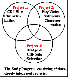
These projects include:
(1) compiling a modern up-to-date GIS database of known dredged material disposal facilities,
which includes characterization of dredged material holdings, estimated quantity,
use history, and ownership,
(2) characterization of the bay waters through sediment distribution mapping, which will
highlight areas likely in need of dredging and characterize the materials to be excavated,
and
(3) spatial data analysis and modeling to determine sites suitable for prospective dredged
material processing centers, and to identify and prioritize areas in need of maintenance
dredging.
Building a GIS Database of Dredged Material Disposal Facilities
The first project consists of compiling a modern up-to-date GIS database of known
dredged material disposal facilities known as confined disposal facilities (CDFs).
The database is to include include characterization of dredged material holdings,
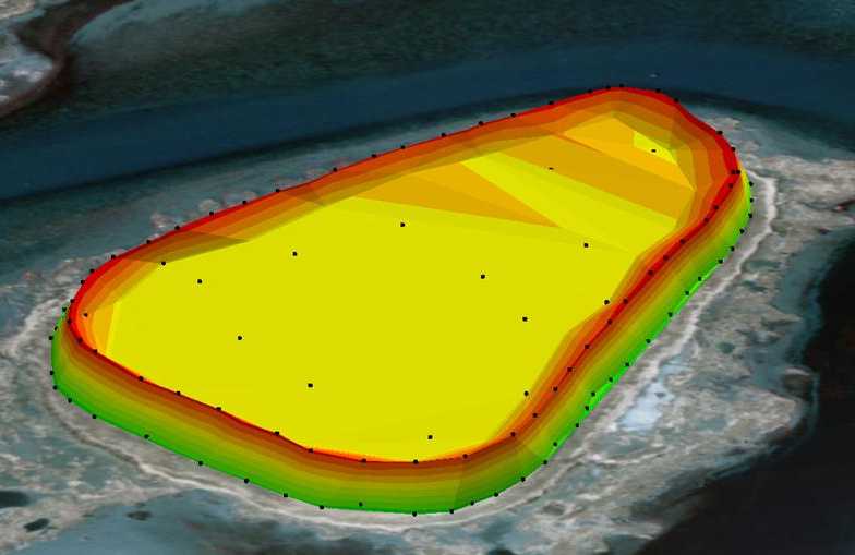
estimated quantity, use history, and ownership.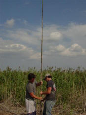 Confined disposal facilities are identified and delineated though the use aerial photography
in GIS. After they are identified, they are visited by a field crew that collects
sediment samples and X, Y, Z coordinates. The sediment samples are collected with
soil augers, piston cores, and soil probes to attain samples from the surface of the
CDF down to the top of the salt marsh. The coordinates are gathered with RTK GPS
surveying equipment covering the CDF. With this data the volume of can be determined
for each individual CDF. The ownership and history are found through lot and block
parcel IDs.
Confined disposal facilities are identified and delineated though the use aerial photography
in GIS. After they are identified, they are visited by a field crew that collects
sediment samples and X, Y, Z coordinates. The sediment samples are collected with
soil augers, piston cores, and soil probes to attain samples from the surface of the
CDF down to the top of the salt marsh. The coordinates are gathered with RTK GPS
surveying equipment covering the CDF. With this data the volume of can be determined
for each individual CDF. The ownership and history are found through lot and block
parcel IDs.

